Eighty years ago, a group of four hardy souls from the Ptarmigan Climbing Club (Bill Cox, Calder Bressler, Ray W. Clough, and Tom Myers) set out to discover what lay south of Cascade Pass, and although they (and many subsequent explorers) found out, words can’t do such a place justice.
So, last week Aubrey and I together with our friend Shawn set out to find out for ourselves, following the now famous mountaineering route called the Ptarmigan Traverse. The route begins at Cascade Pass, and follows the Cascade Crest closely for about 15 miles southward, gaining and losing about 8,500 feet, before finally descending 6,000 feet to the confluence of Downy Creek and the Suiattle River (a mild bushwhack). During the traverse the route crosses the crest at least 7 times and travels over five major glaciers and a few nameless ones. The views never stop, in fact, they seem to only get better. Every time we approached a new col, we couldn’t wait to see what visual feast we would find on the other side.

Traversing Ptarmigan : Prints Available
The Ptarmigan Traverse travels through some of the most beautiful and rugged terrain in the lower 48. The route is named after the Ptarmigan Climbing Club, who pioneered the route in 1938. Their name comes from the Ptarmigan, a small chicken-like bird that lives in the Alpine. We were lucky enough to see a mother Ptarmigan and her seven (!!!) babies on our first afternoon. What a view, looking out over the Middle Cascade Glacier and Mt Formidable.
As we travelled through this extraordinarily beautiful and rugged landscape we couldn’t help but wonder what it would have been like for the early pioneers. What gear did they have? What food did they eat? What was their experience like? Although the Ptarmigan crew never published their story, it’s possible to gain just a little insight into their accomplishment by noting a few basic facts.
According a historical mapping database, the most recent topo maps for that area when the Ptarmigans made their trek in 1938 would have been the 1:250,000 USGS quads produced in 1901. These maps had 100 foot contours, and did not label any of the lakes on the route (it’s worth seeing those old maps – search for cascade pass, and select the 1901 Glacier Peak quad). That shouldn’t be terribly surprising, I suppose, given that the maps predate airplanes (the Wright Brothers first flew in 1903). Thus, the topography could only have been generated from photographs and measurements taken from nearby peaks. But, with none of those peaks having been climbed in 1901, there must have been a substantial amount of interpolation involved. Given these limitations, the quality of the maps is actually quite extraordinary. Of course, the Ptarmigans probably had some notes from their friends and prior trips to mountains in the area, but a lot of mystery would have remained.
Not only were the Ptarmigans the first to find their way across this landscape, they actually had to do it twice. At the time, the Cascade River Road to Cascade Pass hadn’t been completed (that wouldn’t happen until a decade later), so they hiked from Sulphur Creek to Cascade Pass, and back again. Oh, and they summited every major peak along the way (most of them first ascents).
Because of the second world war, and the remoteness of the adventure, the trek wasn’t repeated until fifteen years later. For this second trip, in 1953, Dale Cole, Bob Grant, Mike Hane, Erick Karlsson and Tom Miller, took advantage of the new Cascade River Road to hike south from Cascade Pass (reversing the original itinerary). This trip was, again, before the USGS had updated these maps, and a full decade before the first 1:24,000 quads for that area were published. They did publish their story, and you can read about it here: South of Cascade Pass (page 38).
The only major change to the mountaineering route people take today, and the 1953 route, is a preference for climbing up Le Conte Glacier instead of going over the pass just south of Le Conte Mountain (which involved a steep and rocky descent to the South Cascade Glacier). Looking at the old maps, it’s easy to see why this wasn’t an obvious route.
Tom Miller, of the 1953 party, brought his camera and published his photos in a 1964 book, which proved important in designating the North Cascades as a National Park in 1968. Ironically, the vast majority of the Ptarmigan Traverse itself lies outside the National Park. Fortunately most of the traverse is protected by its shear remoteness, and the generally good ethics exhibited by people who travel there.
~ ~ ~ OUR ADVENTURE ~ ~ ~
Now that you know a little of the history, I can recount our story. Compared to those first explorers, it doesn’t feel like much of an adventure, but was one of the most beautiful and fulfilling “hikes” I’ve done! To be clear, this is not a backpacking route. It requires technical knowledge, glacier travel, and general backcountry mountaineering expertise. We took the standard 5 days to really enjoy the trek, but the entire route has been done by crampon-wearing long distance runners in just over 12 hours. I recommend taking the extra time!
Hover your mouse over some of the images to reveal our approximate route.
Click to see pop-up bigger view.
More photos here.
~ ~ ~ DAY 1 ~ ~ ~
The trek started with an easy and wonderfully maintained trail to Cascade Pass. Others have commented that the trail was “designed by someone who thought humans should never be forced to walk perceptibly uphill” [ref]. Relative to the rest of the route that may be true, but you’re still gaining 1,800 feet before you’ve eaten any of your food!
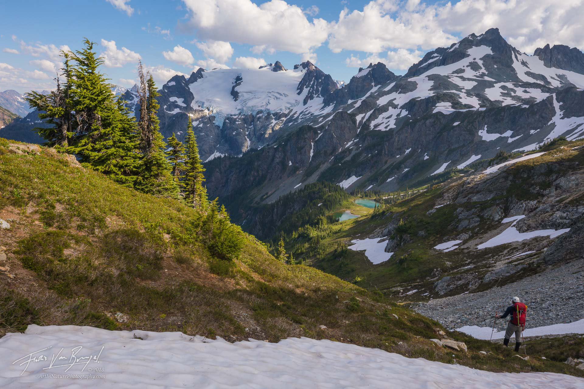
At the pass, we stopped for a snack, checked the map, and started making our way to Cache Col. The route clings to some steep scree and can’t-slip snow slopes above the Pelton Basin. This is the qualifying exam. If you get through that section without too much of an adrenaline rush, you’ll be okay for the rest of the route.
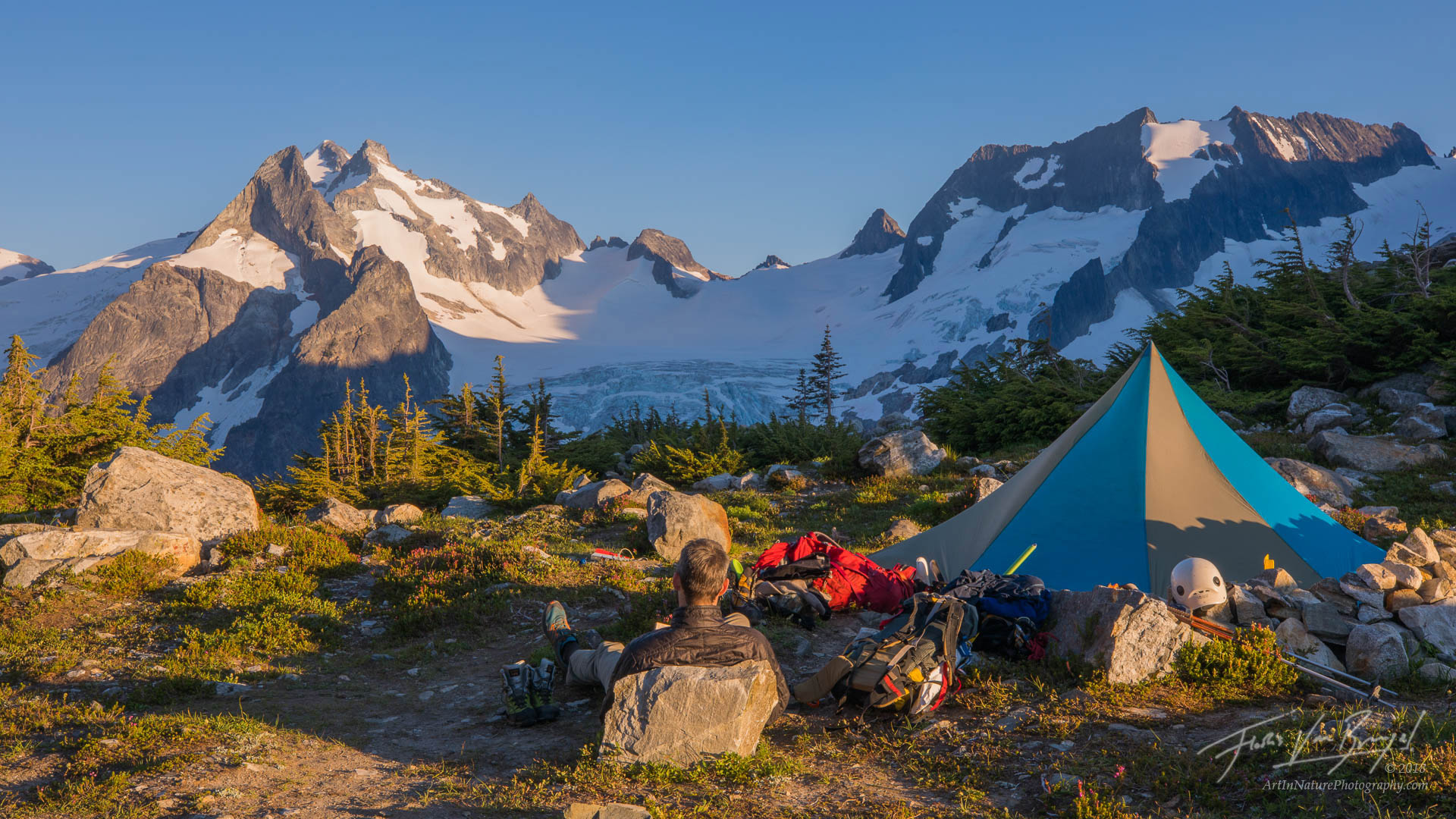
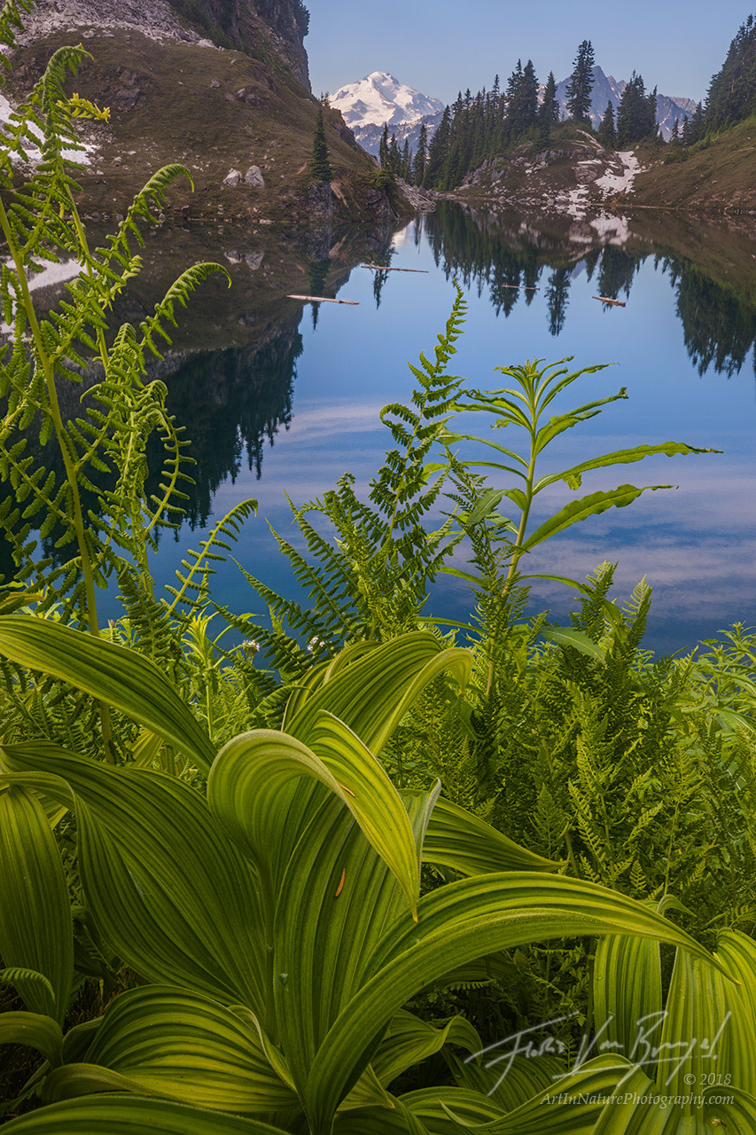
Around the bend we arrived at the first glacier of the trip, Cache Glacier. It’s the mildest glacier, and was a good opportunity to practice roping up and finding our group pace. Before long we were at Cache Col, with a superb view of Mt Formidable to the south. As we made our way to Kool-Aid Lake, where we would camp for the night, we stumbled upon a mother Ptarmigan, and her seven chicks. I couldn’t have hoped for a better start to the trip, than to see the routes namesake bird on our first day (image at the top of the page)!
To our delight, we had the half-melted-out Kool-Aid lake all to ourselves that evening, and immediately went for the first of our alpine swims in the patch of open water.
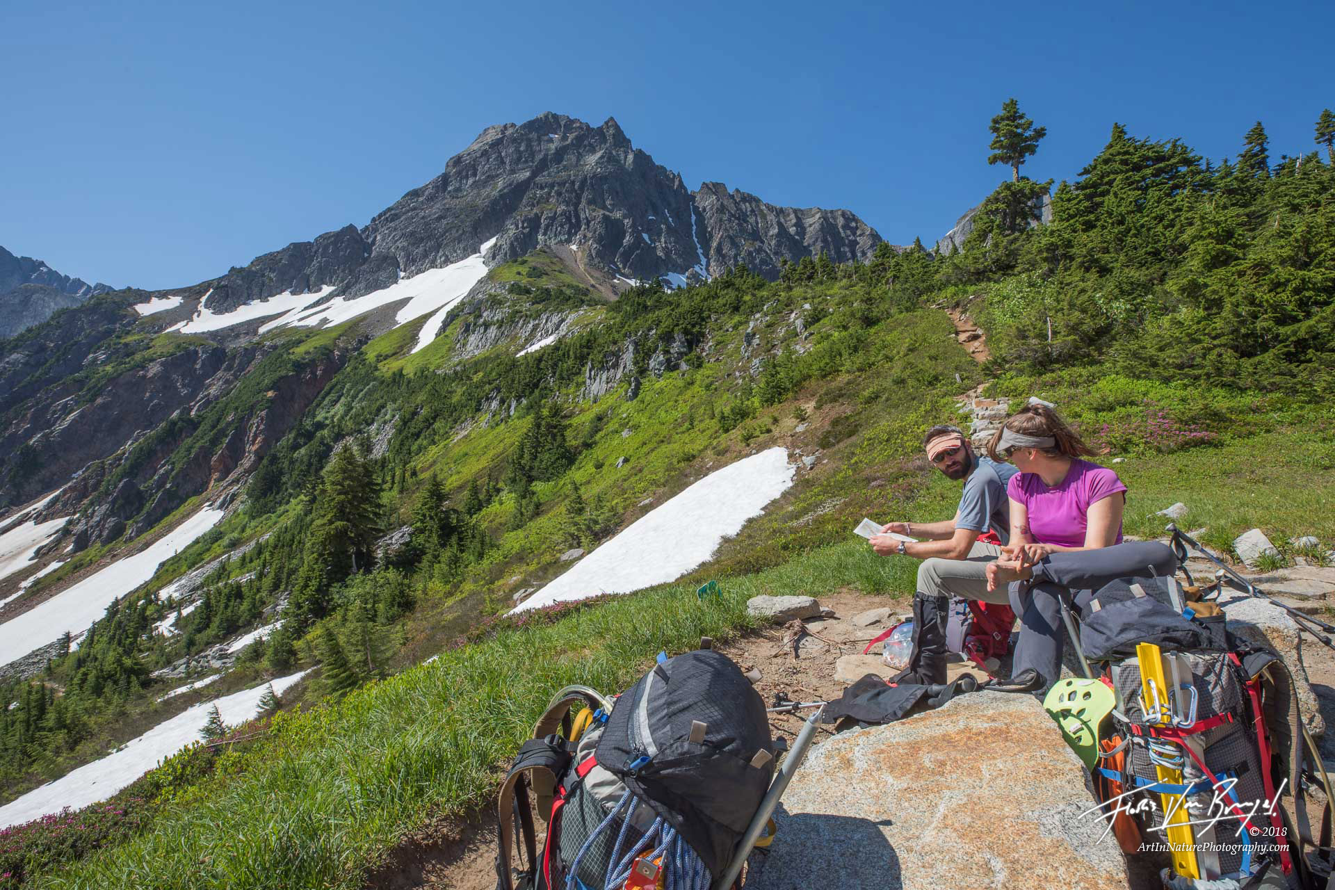
Taking a look at the map before we leave the (official) trail, and head for the mountains. Hover your mouse over the image to reveal our approximate route.
Shawn ascending up to Cache Col. We came from Cascade Pass, which is around the corner. Hover your mouse over the image to reveal our approximate route.
Our first campsite, at Kool Aid Lake. We had the entire place to ourselves that night! Views of Mt Formidable and the Middle Cascade Glacier in the distance.
~ ~ ~ DAY 2 ~ ~ ~
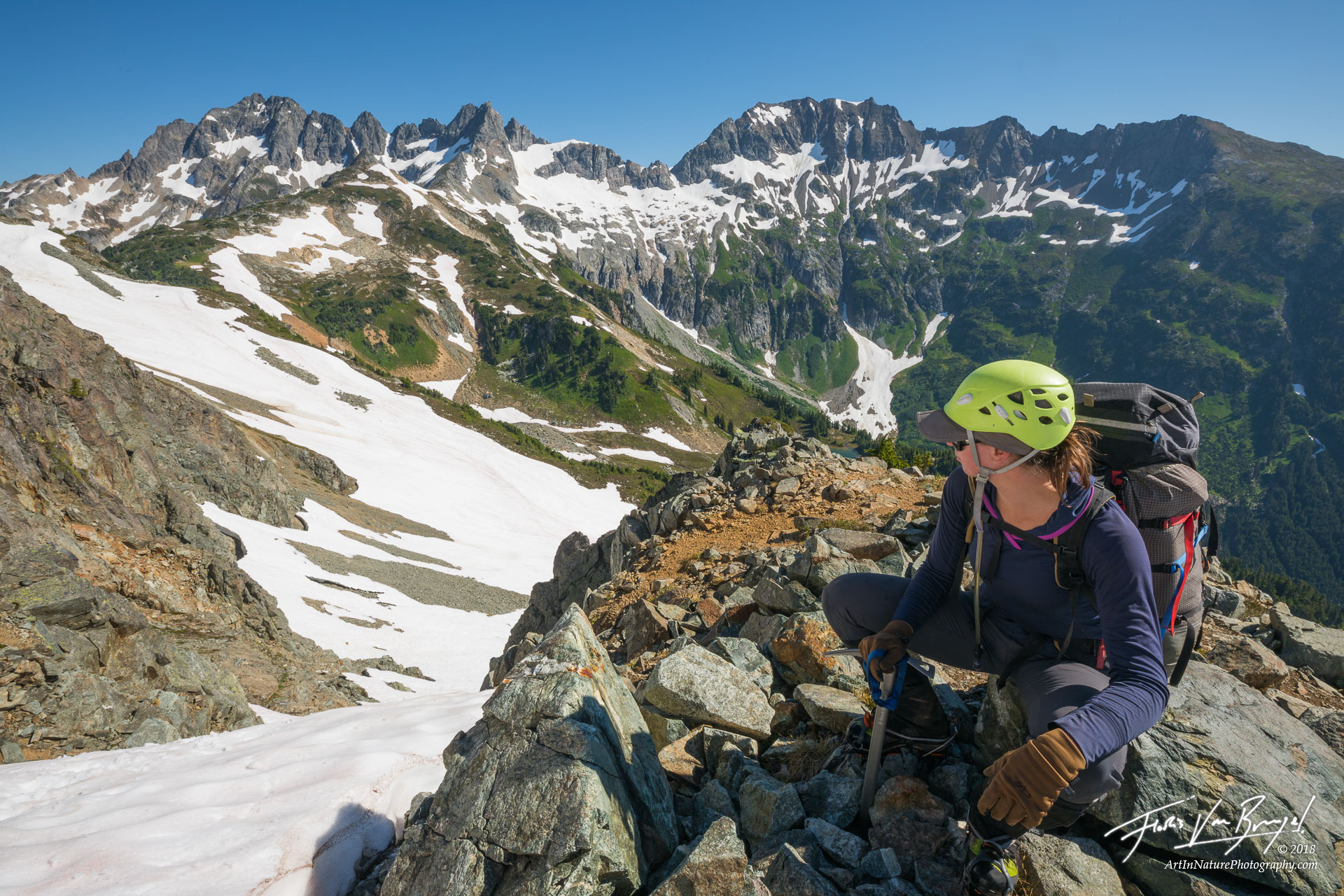
Day 2 involves two sections that had made us rather anxious while reading all the route information: the infamous red ledge, and the steep descent from the Spider-Formidable Col. That morning we drank our morning coffee and looked out at the red ledge, an improbable looking route across a colorful band of rock in a steep cliff face. From camp, it doesn’t look possible. But then we saw two white specs–a mother goat and her baby–traversing the ledge. After realizing the it was lagging a little, the goatling sprinted across the ledge in a few seconds to catch up with mom. If a baby goat can sprint it, surely we could walk it?
Fortunately, we had timed the snow conditions just right, and getting onto the ledges (the trickiest part) was relatively easy. From there it was, as the goats had demonstrated earlier, an easy path through the cliff band. From here we traversed towards the Middle Cascade Glacier, passing safely above some impressive seracs in the blue glacial ice below. We roped up and made our way to the Spider-Formidable Col, where we feasted on the new view, jalapeño-cheese sausage sticks, and some spicy mangoes.
The descent from the Col is just steep enough that you can’t see what’s below, making it a little unnerving to commit. We had lots of time, and lots of aluminum pickets, so we set an anchor and Aubrey belayed me down so I could get a good look. Right about at the end of our rope (130 ft), I could finally see a clear path all the way down. I set a new anchor, and brought in Shawn and Aubrey. From there, we determined it was safe to glissade the rest of the way – our favorite mode of downhill movement on summer snow!
At the bottom, we strapped on the crampons again, and made the scenic traverse towards Yang Yang Lakes, which would be our camp for night 2. The lakes really are quite spectacular, devoid of all Yin, and solidly full of Yang. (Yin = negative/dark; Yang = positive/bright).
One of the steeper sections on the route is descending from the Spider-Formidable Col. It's just steep enough that you can't see over the edge, but it turned out to be entirely glissadable. Hover your mouse over the image to reveal our approximate route.
Shawn starts the descent to Yang Yang lakes, our camp for night 2. Hover your mouse over the image to reveal our approximate route.
Ying and Yang Yang : Prints Available
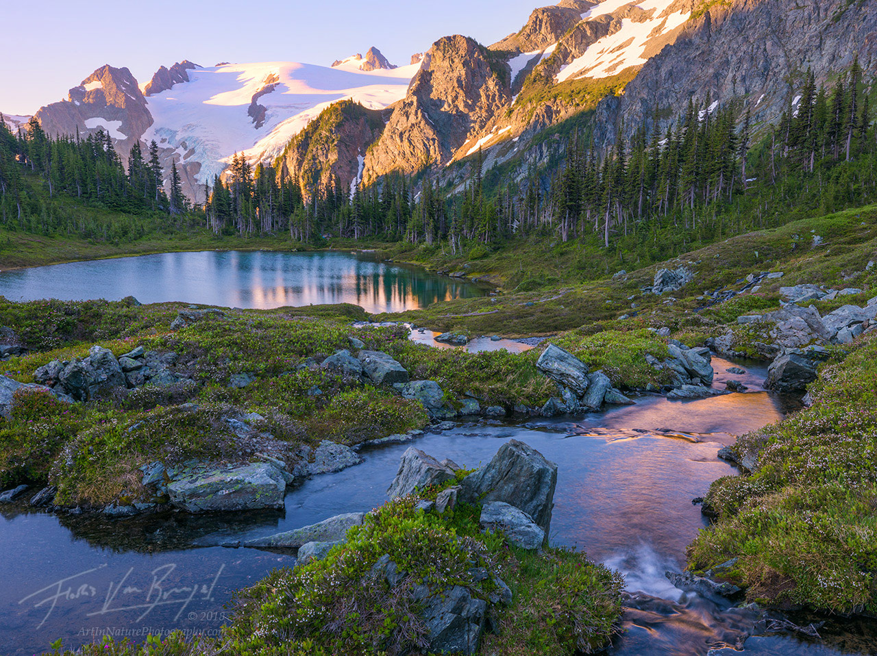
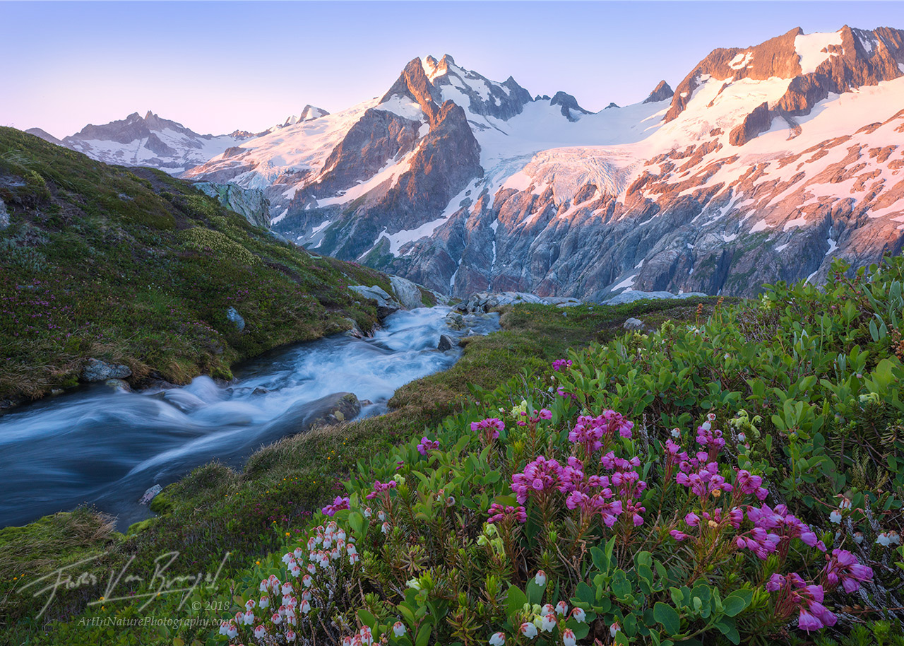
Sunrise on the Le Conte Glacier, seen from the Yang Yang lakes.
~ ~ ~ DAY 3 ~ ~ ~
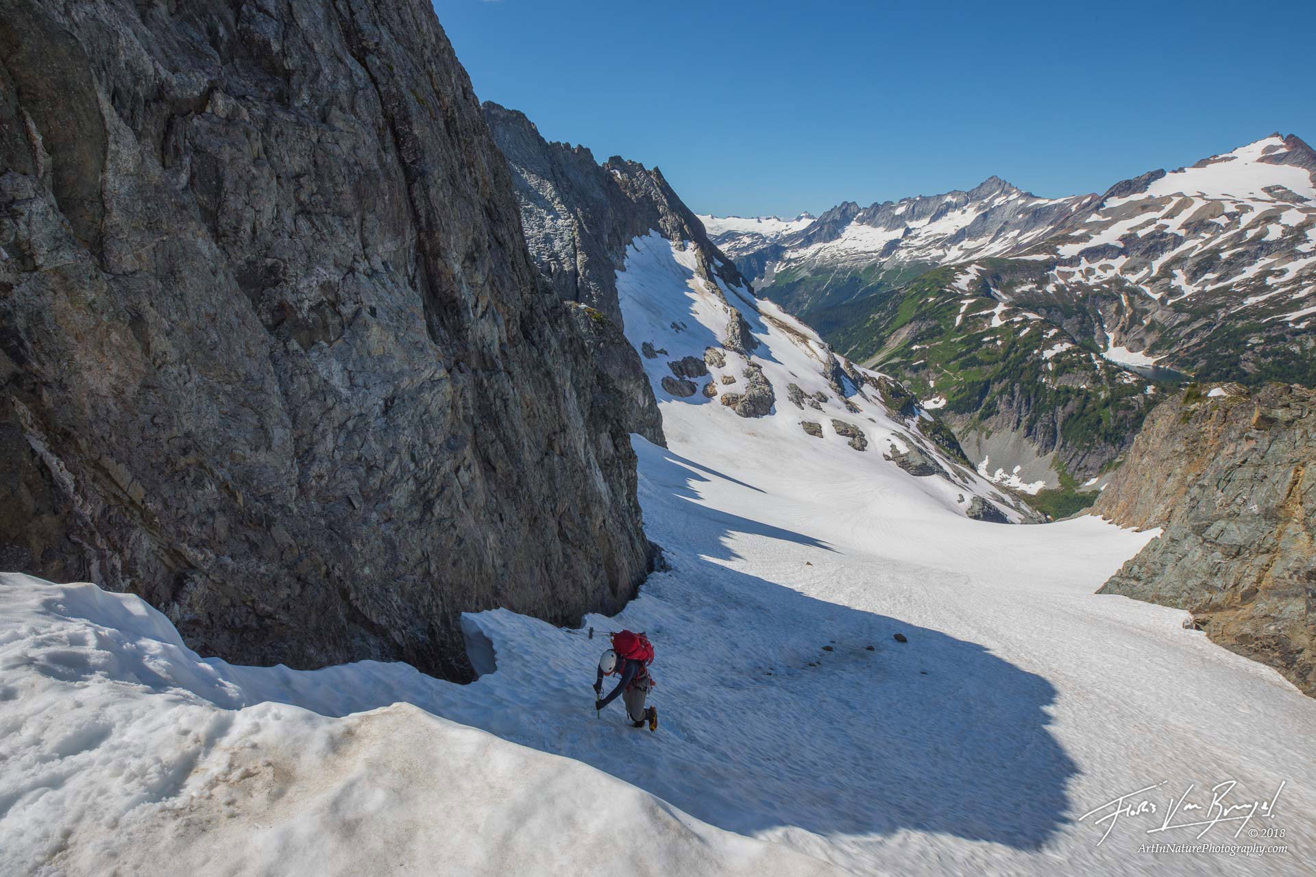
Day 3 started with a steep descent up a narrow snow gully, which tested our comfort with the crampons and axe. By this point in the trip, we were feeling more at home on the snow, and thanks to the day-old boot pack, it was a relatively easy ascent. From there we traversed the crest for a ways, waving good-bye to Mt Baker as we skirted the east flanks of Le-Conte Mountain towards the Le-Conte Glacier. Prof. Le-Conte must have made quite an impression on his peers, as there are at least three mountains that bear his name (in the Sierra, the Smokies, and the Cascades). I suppose it’s fair, as we was a physician, geologist, and a conservationist.
The Le Conte Glacier is the most active along the route, and we had read stories of parties that got turned around here, or had to climb in and out of icy crevasses to get through. Again, however, the snow-gods smiled on us, and we faced no such problems in getting onto the glacier as there was still a healthy layer of consolidated snow covering any would-be obstacles. We placed a few pickets for back up on the steep section, and then it was a long and easy slog to the pass.
At the pass, we crossed the crest yet again, gaining a new view, this time of the South Cascade Glacier. Compared to the maps, and historical images, this glacier has retreated the most in the past 50 years, losing close to half a mile in that time (image comparison here, and for me see: The Ptarmigan Traverse – Then and Now).
Up until this point we had been following some mysterious, and expertly routed boot tracks. Now, for the first time in the trip, we could see our mysterious “guides”. We caught up with them at the pass to White Rock Lakes, and had the benefit of their reconnaissance to know that we could safely glissade almost the whole way down.
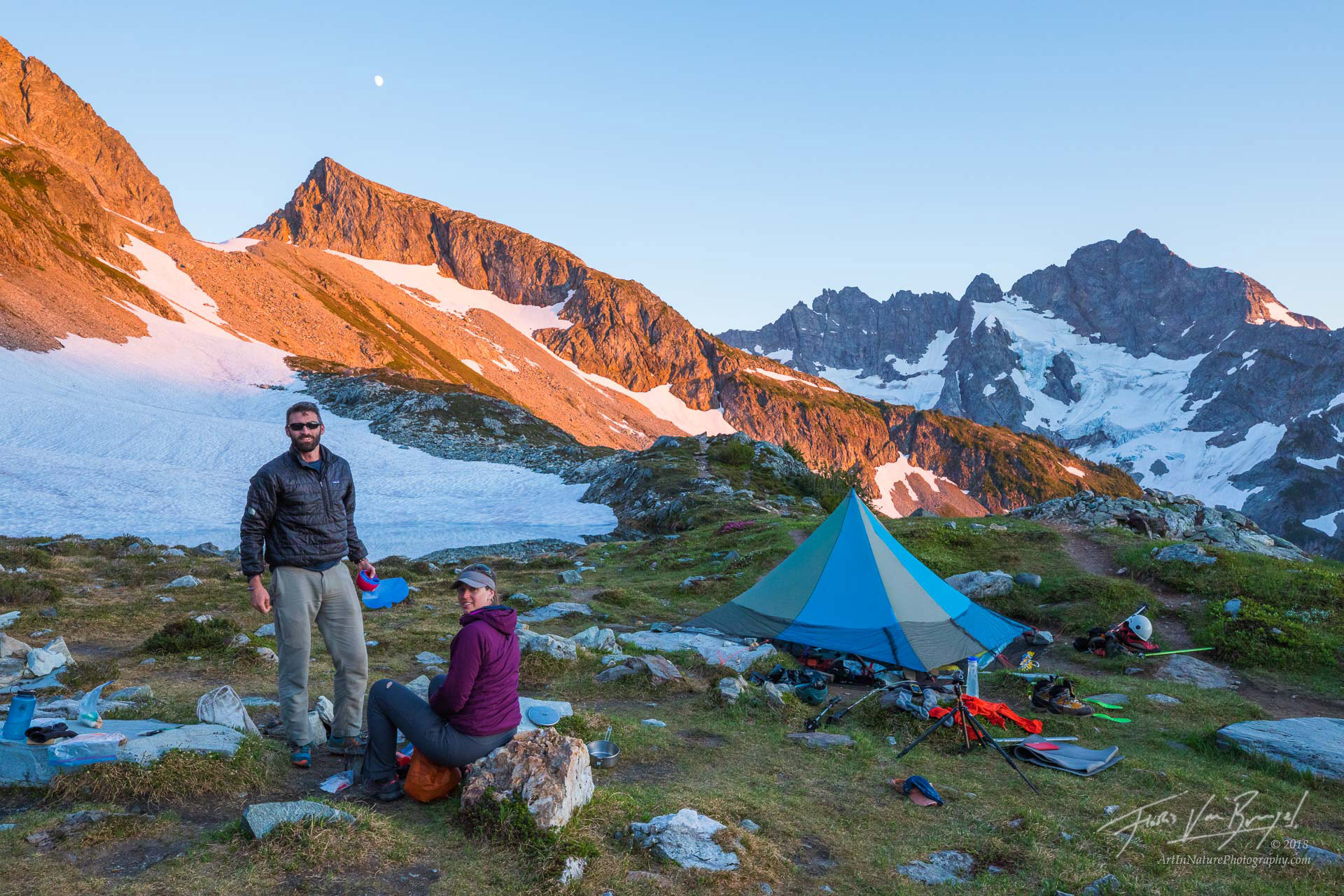
The White Rock Lakes are the most spectacular campsite on the traverse, with commanding views of Dome Peak and the hanging Dana and Dome Glaciers. In addition to having time the snow just right, we also seemed to have hit peak heather-blooming time. All along our route I had been trying to find nice compositions with these delicate and colorful pink flowers. Finally, with the view of Dome at sunrise, I had found what I was looking for. A few clouds would have been nice, but the rich morning light made up for it.
Aubrey takes in the view after ascending a snow gully above Yang Yang lakes. Hover your mouse over the image to reveal our approximate route.

Shawn, always on the lookout for an opportunity to hydrate. This time, right before we ascend the Le Conte Glacier.

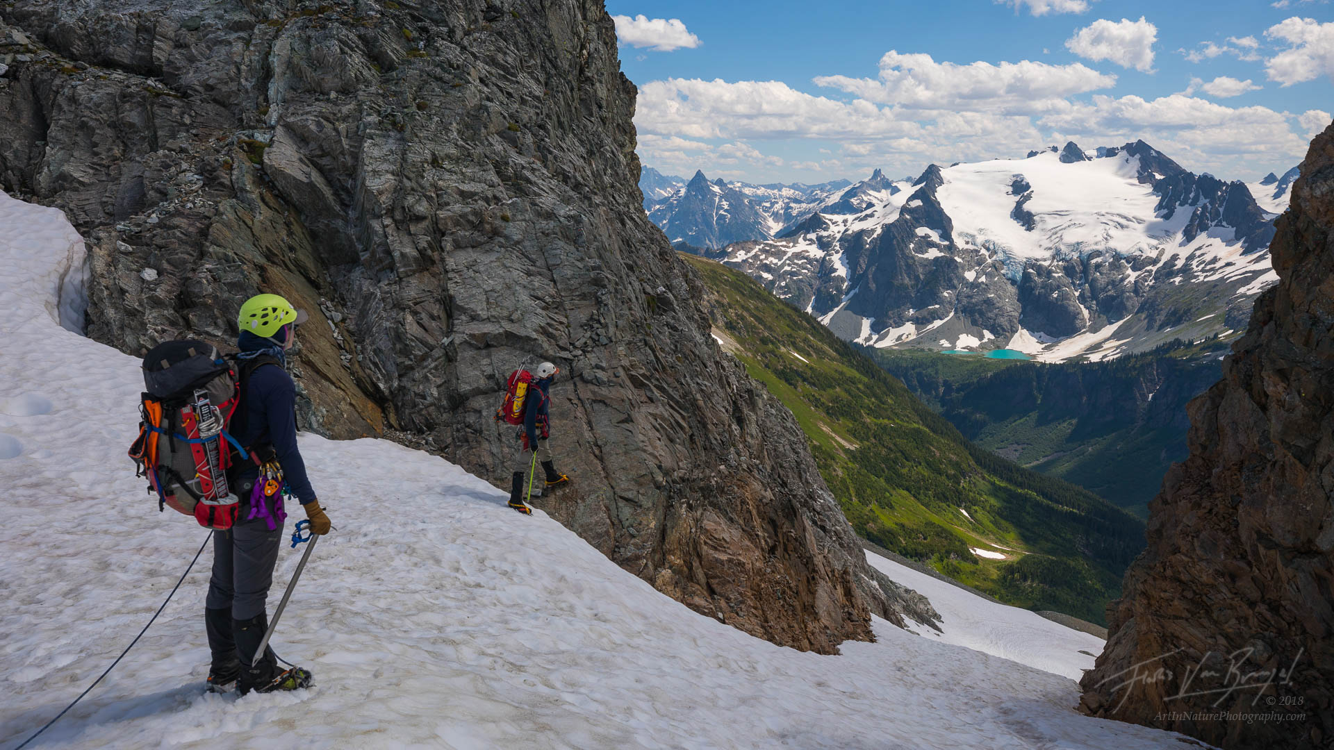
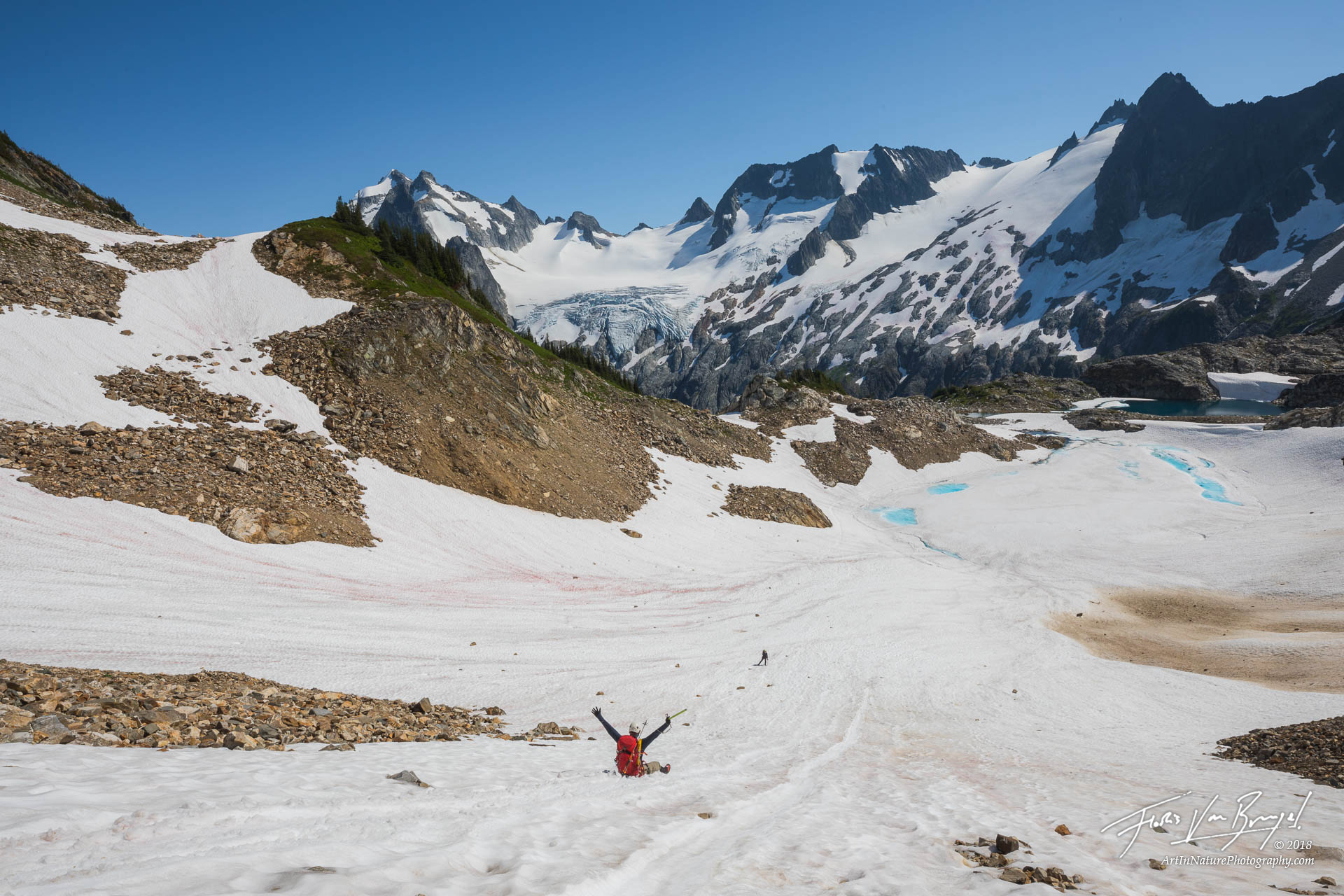
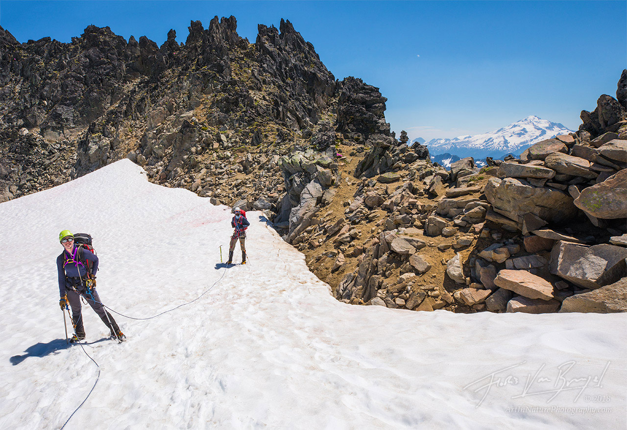
Aubrey makes a gratuitous hop over a tiny crevasse. You couldn't have gotten your big toe stuck in it if you tried...
A delightful glissade down to White Rock Lakes. Why people would choose to walk down these slopes was beyond our understanding... Hover your mouse over the image to reveal our approximate route.
Alpine Bliss : Prints Available
Classic view of Dome Peak at sunrise, near our camp at White Rock Lakes. Some blooming alpine heather completes the alpine feel.
~ ~ ~ DAY 4 ~ ~ ~
Day 4 was the first time on our trip where we debated what the correct route was. The route we had indicated on the map said one thing, the description said another, and the topography suggested that both would work. We watched one other group take the low route, so we opted to explore the high route. In retrospect, the low route was probably the better choice for our conditions, and the high route better for a ski-traverse, but it worked out fine in the end.
We roped up on the Dana Glacier, our final one for the trip. It was a long way up to Sentinel Pass. One step in front of the other.. it never seemed to end. Finally we made it, and had lunch on the rocky pass with a new and final view: Glacier Peak. After a little route finding on the way down, we easily glissaded to Itswoot Ridge, and made camp on a curiously shaped snow bank. Why? Because it would make for a more interesting photo and experience than camping on dirt! Also, it was an excuse to use the shovel we’d brought for naught. We had plenty of time, so we made this camp a palace, complete with a flagstone entry path.
High point of the traverse - at the top of Dana Glacier, with a view of Glacier Peak in the distance.
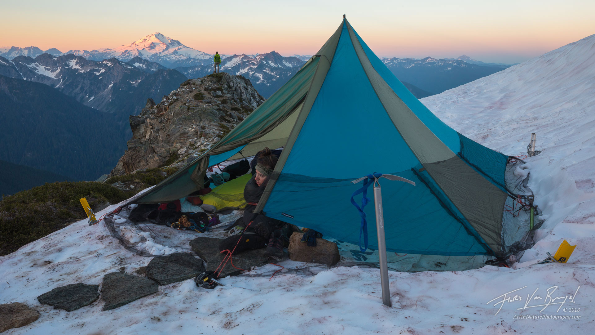
Sunrise on Itswoot Ridge, with a view of Glacier Peak. Aubrey takes in the view of the hanging glaciers on Dome Peak from her sleeping bag. Note the custom mosquito netting skirt around the megamid. Aubrey and I designed and sewed it, and it was a life saver, even up here on the snow!
~ ~ ~ DAY 5 ~ ~ ~
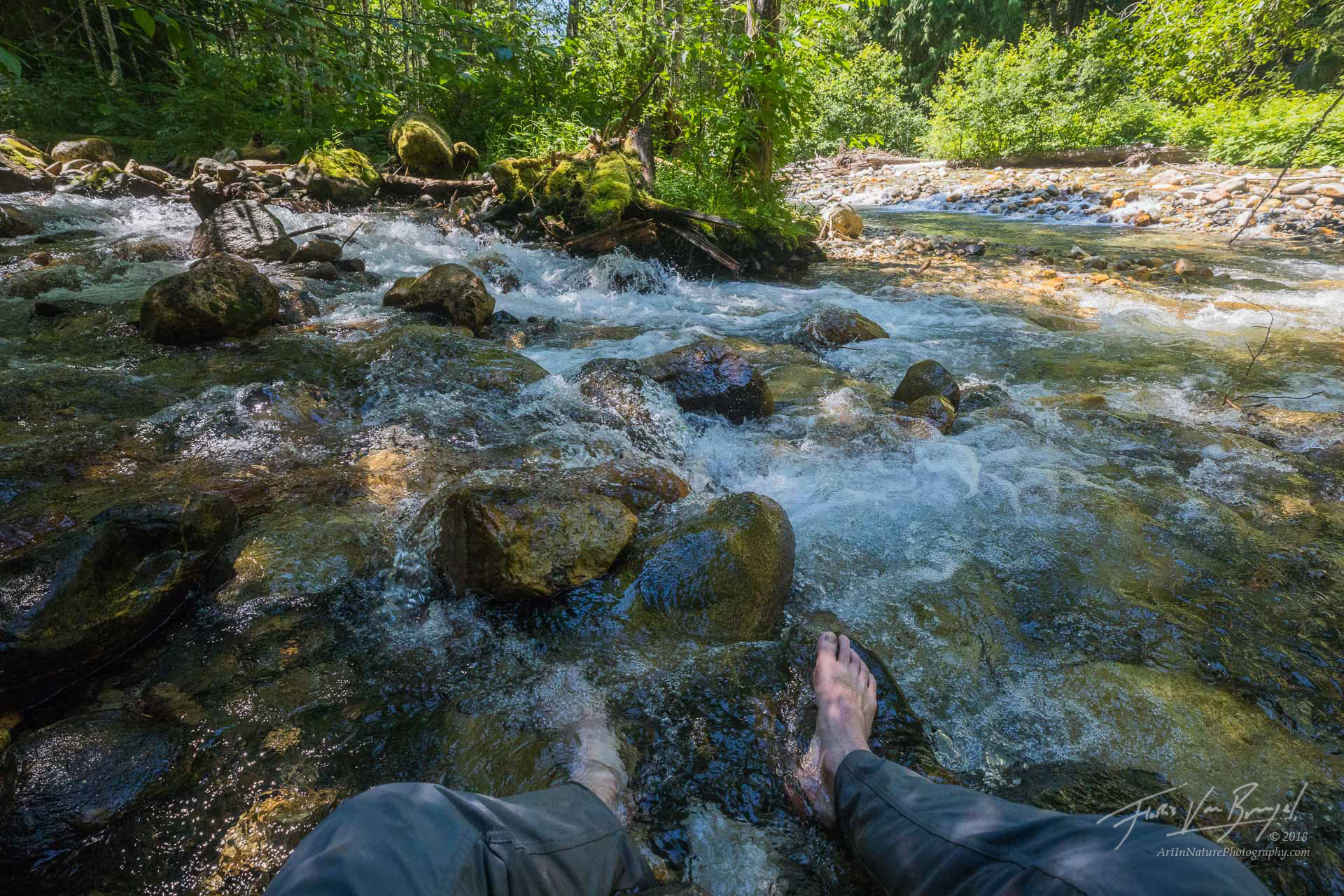
After a lovely sunrise, we said goodbye to the hanging Chickamin Glacier, Dome Peak, and our days in the alpine, and started our 6,000 foot descent into the jungle that is the low elevation Cascades. Cub Lake provided the last view of Glacier Peak, before we entered the brush. Most of the reports online suggest that the hike out is a bushwhack, and I admit that there are indeed some bushes that need to be whacked to get through, but it is not a true bushwhack. A true bushwhack is one where you lose everything attached to the outside of your pack in a stand of slide alder, the devil’s club attacks any exposed flesh, and it takes 2 hours to travel a mile. There was a (good) trail, you just have to be careful to stay on it. One wrong turn, though, and you would truly regret it. But before too long we found ourselves at the “bottom”, and soaked our sore feet in Bachelor Creek before following the maintained trail along Downy Creek back to our car shuttle.
Want to see more photos? Here you go!
Verdant Views : Prints Available
Back in the land of emerald green, and bugs, and our last glimpse of Glacier Peak.
Tags: backpacking, cascades, mountaineering, mountains, ptarmigan traverse
Dude, I’m floored! Looks amazing!
This is great Floris! Looks like an awesome adventure.
Remarkable photos, Floris! Looks like one helluva time.
Great trip report Floris, looks like we have a common interest in documenting our mountain adventures =)
Would still love to have you on my podcast someday – everyone I’ve had on has recommended you, it seems like. =)
Lovely adventure Floris, and a great story with beautiful photographs. Wish I could have been there with you all.